
Aka, the century that wasn't. Before I get on the the rest of the report, let me just get it out of the way - the full century didn't happen. A lot of different factors played a role, and it was still a fantastic training ride, but I'd be lying if I said a part of me wasn't a little disappointed. I will break that triple digit barrier soon enough, yesterday just wasn't that day. And now on the the recap!
The morning started much earlier that I would've liked, leaving Sacramento around 6:15am for the hourish drive to the little town of Lotus in the Coloma Valley. There was a little group of us triathletes doing the ride (either the 102 or 67 miles) so we all met up at the start, easy to find one another since our tri bikes stood out like sore thumbs : ) We checked in, used the bathroom, studied the map, then were off for the first stretch of the ride!
I wasn't sure how my legs would feel after such a big week of training, but was pleased that they didn't feel like lead. I did feel tired though, so I knew it would still be a long day. I had great company though - my coworker, Anandi, and One10 teammate Kevin, both also doing Cd'A, were attempting the century with me, and One10 teammate Amity and her friend Carrie, who are both training for IM Canada, were going to do the 67 miles course. We were quite the group riding along as 4 of us had Cervelo tri bikes, 3 the exact same P2 model!

the (unofficial) Team Cervelo! Carrie, Kevin, me, & Amity
The first 10 miles weren't too bad, but they were full of rollers as we headed for the little town of Cool. Nothing long or steep, but we were constantly going either up or down. I've never rode in a group outside of a race situation, so I tried not to stay within myself and listen to my body rather than try and push it to stay with someone who's faster. We all sort of did our own thing, since some of us excel more at climbing, descending, or flats. We were never too far from one another, and met up at each aid station to regroup. At the first aid station there was an array of breakfast foods, but I wasn't hungry yet so I grabbed an orange slice and nibbled on a Honey Stinger waffle. I also tried to figure out my heart rate, which hadn't been working since we started, but it continued to be on the fritz so I ended up just turning it off. Kind of wish I'd had it since I'm pretty sure I reached an all time high later in the ride!
We continued on with 16 miles til the next aid stop. The rollers continued, and one in particular didn't seem to end. It wasn't steep, but it went on and on. None of us had really studied the elevation profile closely, so we had no idea how long it was, and every corner we'd turn it would just keep going up! My new cassette (I switched to one that's better for climbing) made a huge difference on the hills. I felt like I could actually "spin" up them better. On the steep stuff that came later it didn't make as much of a difference, but on the long, steady climbs it was awesome. This hill in particular ended up being about 4.5 miles, and we were all pretty happy to finally reach the top. From there we had a nice, long, winding descent that lead us to the next aid stop. We hung out for a bit and snacked, used the bathroom, and quizzed the volunteers on what the next section was like. We were told it was "pretty easy" with a long descent through Coloma Valley. After that last climb we were looking forward to it!

aid stop #2

The next section began exactly as it had been described - a long, sometimes precarious, winding descent down Garden Valley Road through Coloma Valley with breathtaking views of the green hills and American River below. We stopped a couple times for photo ops and then turned onto the less-than-smooth Rock Creek Road. This section was maddening as it looked like a slight downhill, but felt like we were going uphill...which we were. We eventually did start descending again and eventually found ourselves at the bottom, crossing the river at Rock Creek Bridge. Now what we all failed to think about as we were flying down the road a few miles earlier is that we'd have to climb back out of the valley. And sure enough, after crossing the bridge, we did just that. Another good 4+ mile climb which, again, never seemed to end. That was one of the most maddening things, not knowing how long the hills were and not being able to see the top!

the first of many stunning views of Coloma Valley

just hanging out

American River


Rock Creek Bridge

We somehow made it out of the valley and to the next aid stop at Finnon Reservoir around mile 44ish. We had planned to stop briefly and continue on to the lunch stop, but our legs were all so tired from that climb that we stayed a bit longer and tried to take in some calories and fluids. I was having a tough time taking in calories while riding since we were constantly going either up or down, and looking back I probably should have consumed more. Similarly to trail races I grazed at the aid stations and munched on what looked good - namely watermelon, licorice, and boiled and salted potatoes. It had also started to really warm up - it would get to 90 degrees by the end of the ride - so fluids were critical, too. Once again we inquired about the next section (note to self: study the course map/profile in advance!). We were told there was a big descent down to Mosquito Bridge, then a climb up to Placerville. The latter was supposed to be short and steep after the bridge, and then fairly gradual. That would turn out to be the understatement of the century.

aid stop #3
Unfortunately that climb didn't crest at the aid stop, so we had a little ways to go before we finally reached the top. Then we had the scariest descent I've ever done. It was long, steep, and winding with hairpin turns, and barely wide enough for a bike and a car. It was here that my hands started killing me from holding on so tightly and braking so much. You literally could not let up the brakes without immediately gaining a ton of speed. Both Amity and Carrie had to stop a couple times just to rest their hands and compose themselves, and I kind of wish I had, too. Riding downhill can definitely be fun, but this was nothing like that. I was so thankful when I reached the bottom, but my hands felt raw and my heart was pounding. The video below shows the last section of this descent down to the bridge, but doesn't quite do justice to how it feels in real life.

Mosquito Bridge


that middle section is tricky!
When I reached Mosquito Bridge I noticed the smell of burning rubber. Immediately after the bridge there was a steep climb so I figured I'd keep my momentum going and start up it, but within a few feet my bike was making horrible screeching noises with every pedal stroke, so I stopped and headed back to the bridge to wait for the others and figure out what the hell was going on with my bike. I was just hoping I hadn't burned out my brakes! When Kevin got there we looked at my bike and we realized that my back tire was too close to the frame and was rubbing. We (ok, he) thought that the heat had caused the air in my tire to expand, which closed the gap between my tire and the frame. That had been what the smell was, too; the friction between my tire and bike frame as I was coming down that hill. We released a bit of air and hoped that would help.
What followed is one of the hardest things I've done in my life. Seriously, the climb up from that bridge was so hard I almost simultaneously puked, cried, and had a heart attack. Plenty of people walked up part of it, and everyone was crawling up. The first half mile seemed almost vertical; we found out later it was a good 20+ grade at the steepest point. The only reason I didn't stop was because I knew I wouldn't be able to get going again on something so steep. My bike continued to screech as I climbed, which made everyone look at me in the midst of my hardest climb ever, dripping in sweat and grunting with effort. I'm sure I looked lovely. There was a little plateau after the steepest part and I unclipped and could barely stand on my wobbly legs. I was gasping for air, and my heart rate was surely in the nonexistent zone 6. Most other riders had stopped, too, and we all commiserated on how tough that was, and tried not to talk about the fact that the road continued up.

pictures don't quite do this hill justice
When Kevin got to the top he looked at my wheel again and this time actually moved it back to create more space. This did the trick and I had no more squeaking (note to self: on a warm day, do not inflate tires to capacity). When we'd all regrouped at the little plateau we reluctantly got back on our bikes and continued. While the worst of the climb was behind us, it kept going, not as steep, but much, much longer. I tried to keep my effort steady and not push, but the entire time my easiest gears did not feel easy enough. Several times I considered stopping, but again I was afraid I wouldn't be able to get going again. I was seriously near tears at the top, and could barely catch my breath. Amity had beat me to the top and was similarly ravaged by the climb. While waiting for our friends we got to chatting with some of the other cyclists who'd stopped for a break and were surprised to hear them all say this was one of the hardest rides they'd ever done, which including some pretty infamous rides and courses. That made me feel a little bit better (and a tiny bit proud).


yes, we're tri geeks : )
After several minutes we still hadn't spotted our friends, and we started to worry. Carrie has been dealing with a lower back issue and Amity was worried all the hills were giving her trouble. Not long after we saw her and Kevin walking their bikes up. Carrie was having a tough time breathing, and so both decided to call it an early day and get SAGed in. This was also when Kevin, Anandi, and I started to voice some reservations about completing the full century. Mercifully the next few miles were a gradual downhill with some flats that lead us into downtown Placerville. We had a couple more little climbs left - because apparently we still needed to earn our lunch - including the one and only hill I walked my bike up. We rounded a corner and the road just went straight up. It was steep, and I knew my legs wouldn't make it all the way up, so rather than risk unclipping halfway and falling, I just said f*ck it and walked up. And let me tell you, just walking that sucker was tough! I met Kevin at the top and we continued the mile or so left to Placer High for the lunch stop.


the one and only hill I did on foot
We grabbed some food and drinks and found a spot in the shade. All we could talk about was how exhausted we were, how much our legs and hands and bums hurt. We started entertaining ideas of stopping at the metric distance and driving to the bike trail for a flat 35 miles to get to 100 for the day. At this point none of us were really considering doing the full anymore, we just had nothing left. It wasn't that we couldn't handle the mileage - I think we absolutely could have. But those last 35 miles had an additional 1,500 ft. of climbing with a 620 ft. climb up Pilot Hill, and our legs definitely could not have handled that. We took a long break here, resting our legs, eating (I definitely needed more calories at that point), and trying to negotiate a SAG for Amity and Carrie. I checked the website on my phone to see what the course description was for the next section, since up to that point the people we'd talked to hadn't exactly been reliable. Fortunately it described it as a mostly downhill cruise to the finish.
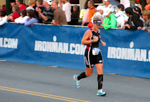
After spending a good hour at the lunch stop we finally found the energy to get back on our bikes and continue on. This was hands down the most mild section of the ride, although it still managed to be slow going on such tired legs. I ended up going ahead of Kevin and Anandi and rode much of this section myself. I encountered a few assholes who felt the need to fly past me at top speed, but tried not to let it get to me. There had been another guy earlier who felt it necessary to flip us off as he passed us. Really? It's unfortunate how little tolerance some people have and how blatantly rude people can be. Not to mention how dangerous their behavior can be, too. Ok, rant over : / Around mile 65 I approached the turn with arrows pointing direction for the 67 milers and the century riders. I was a little bummed to be turning right and cutting it short, but I was also a little happy I wasn't going straight - and right up another nasty hill! There were some nice gradual declines over the last few miles, gentle enough that my hands didn't start cramping from riding the brakes. And then soon enough I recognized my surroundings and found myself back in Lotus where we began our journey nearly 8 hours earlier.

back where we started at the S. Fork of the river
I waited a few minutes for Anandi and Kevin, and as they rolled up both said they were done for the day. I had still hoped to add on some mileage, but it was already 4pm, still hot out, and I was exhausted. Even though I knew it was a great, challenging training ride, I was disappointed that I hadn't accomplished what I'd set out to do. After a few minutes of really thinking about it I decided to call it a day, too. There is still opportunity to tackle 100 miles before race day, and after 67 on a course like that it will be a breeze. The ride ended up being my longest ever by about an hour (total riding time of 5:06), but still under my longest distance ever (70 miles). Based on that info you can see it was slow going yesterday! In all, we had 5,200 ft. of elevation gain over 67.4 miles (although my Garmin says 6,200 ft. strangely). Either way, it's close to what I will see at Ironman (6,100 ft.), which will be spread out over 112 miles. After this ride, I'm much more mentally prepared and confident for Cd'A.

elevation profile
We hung out for a bit and grabbed some food from the organized dinner, relaxed, and talked about the ride. I even chatted with the race director, and when I told him how our day went, he said he didn't recommend this century as someone's first, that it was way too challenging. He said we should be proud to have finished what we did. And, now that I've had a little time to think about it, I am.


With that hill training under your belt Rachel you are going to be SO ready for CdA.
ReplyDeleteHi Rachel. I'm friends with Anande and followed the link to your blog from her FB page. I did the Motherlode yesterday too, but didn't stop to take any photos along the way, so I really enjoyed looking at yours. That was THE hardest ride I'd ever done and Mosquito Rd. almost killed me too. I think I stopped at least 4 times to rest on that climb and the one in Placerville made my legs cramp. I saw people walking up on the other side of the road without bikes and they were having a difficult time. Friends of mine who rode yesterday said it was harder, yes-harder, than the Death Ride and the climbing was under estimated. Your Garmin was probably correct at 6200 ft. Congrats for your accomplishment yesterday and hats off to you for what sounds like an upcoming Ironman. I have true admiration for triathletes like you :)
ReplyDeleteOh my god, I can't even imagine. But your descriptions sound BRUTAL. Nice job toughing it out as much as you could and even better job about being honest with yourself.
ReplyDeleteIn a strange coincidence, I was right outside Placerville this weekend for a wedding! I managed to fit in one run and thought the hills were crazy! I can't imagine how hard it was riding. Congrats on surviving!
ReplyDeleteThose hills sound CRAZY. And the good news is, the new bike course at CdA only has 4,612 feet of climbing!!!
ReplyDeletehttp://ironmancda.com/files/2010/09/CDA_BikeElevation_2012.pdf
Congrats Rachel!
ReplyDeleteTested your limits and came away stronger.
Some folks felt the ride wasn't accurately described. The description on MapmyRide.com lists: Hard Difficulty, Mountain Surroundings, Steep Contour etc. Our website states: thrilling descent, challenging climbs,taxing climbs and steep descents.
In regards to the verticle gain Garmin, Google Earth, and MapmyRide.com all use different algorithims so I suspect I should place all of them on the site and let people choose.
I am going to modify the routes to allow more options next year and build in more comfort by moving it slightly earlier (potentially cooler) in the year.
Regardless it will never be an easy Century. It will remain slightly wild and raw. Thanks for being a pioneer in it's first year and I am confident you will get all 100 done next year!